


쉽게 공유할 이메일, 문자 메시지, 트위터, 페이 스 북, WhatsApp, 등을 통해 GPS 위치. 받는 사람이 그것에 귀하의 위치와 지도 온라인에 대 한 링크를 받습니다. GPS는 지붕에서 잘 작동 하지 않습니다 note 하시기 바랍니다. 최상의 결과 얻으려면 사용 하 여 야외에서.
좌표 형식을 다음과 같습니다.
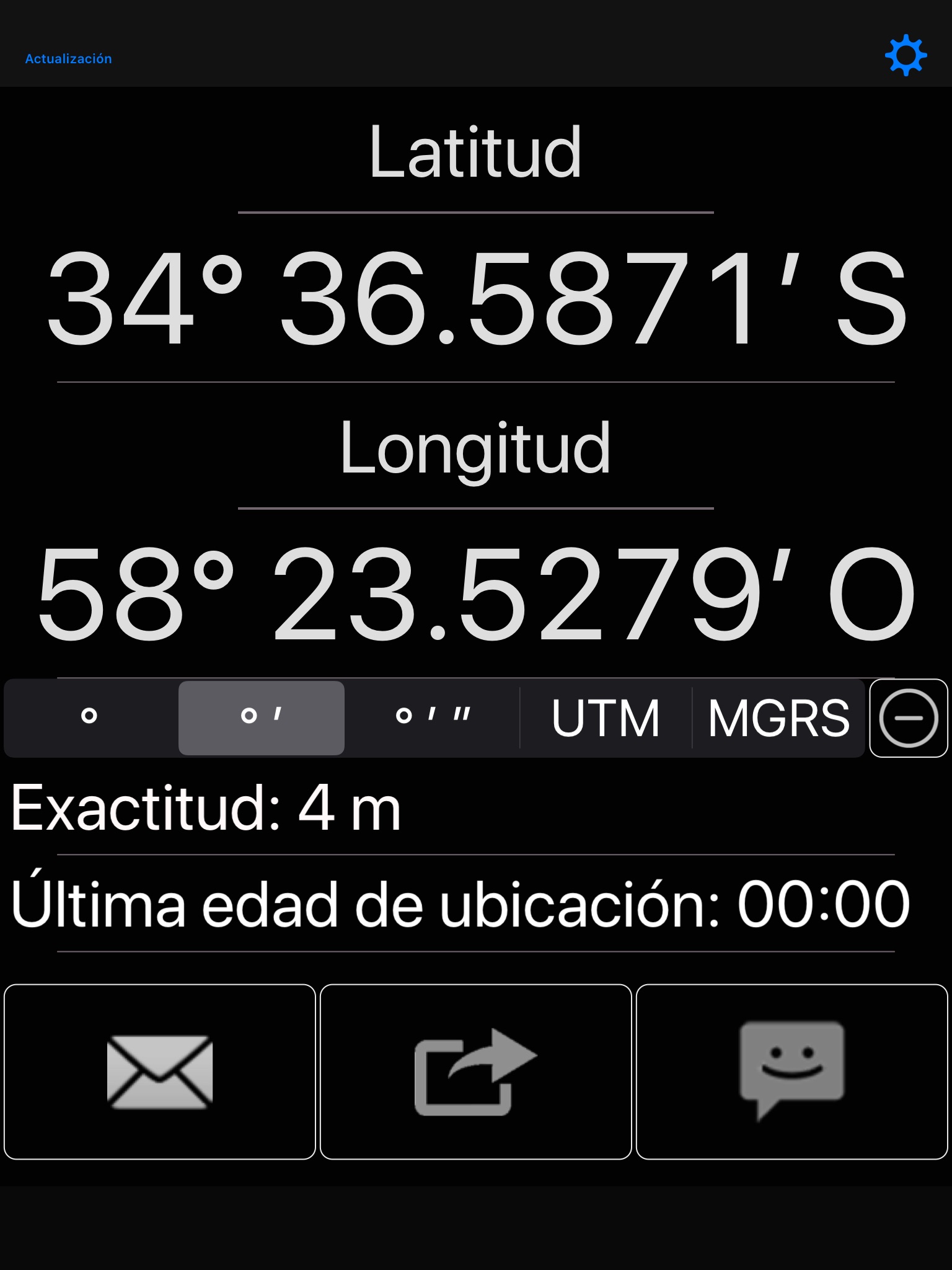
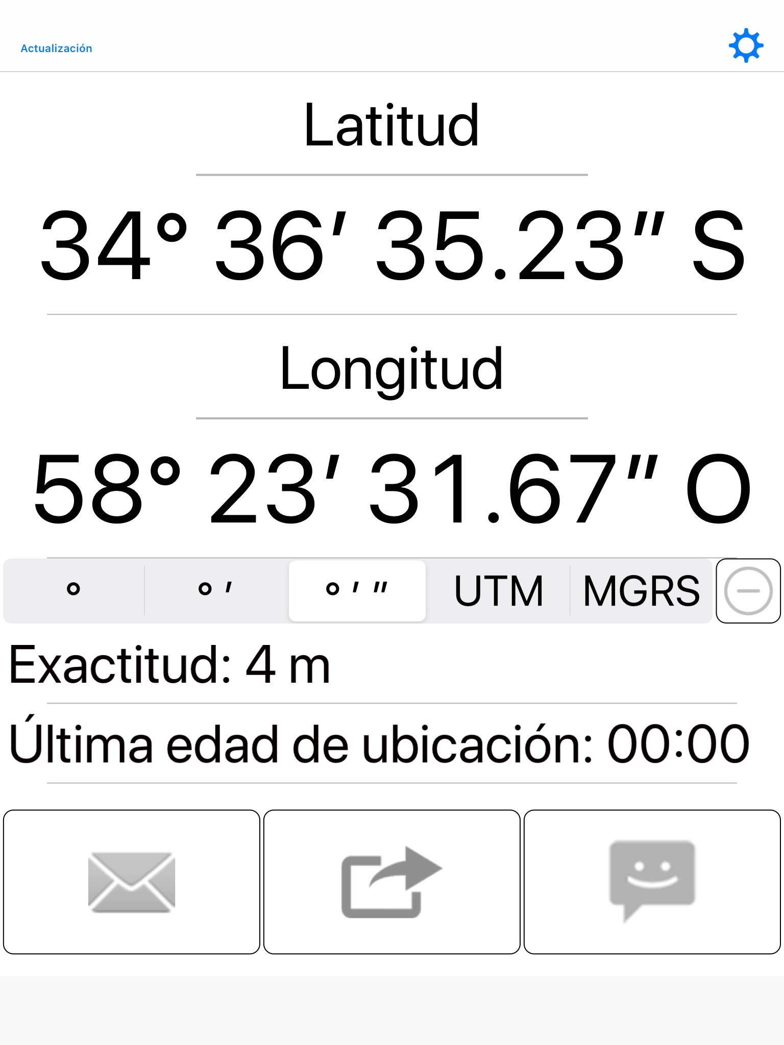
- 도
- 도, 분
- 도, 분, 초
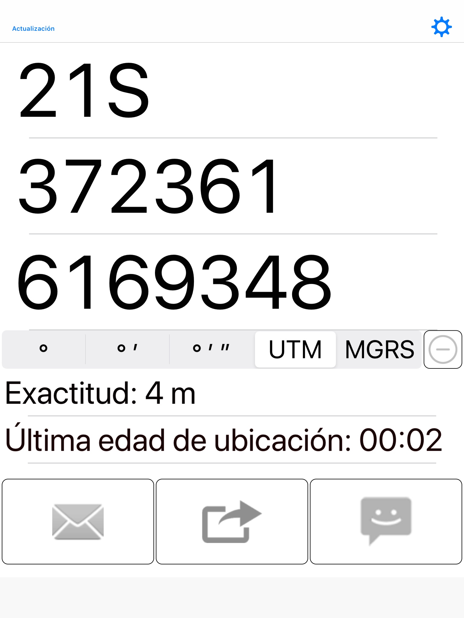
- UTM (범용 횡방향 메르카터)
- MGRS (군사 그리드 참조 시스템)
다음 지도 공급자와 공유:
- 애플 지도
- 구글 맵 스 ™
- 빙 지도 ™
- OpenStreetMap ®
- Yandex.Maps
- HERE.com
- 사용자 정의 URL
다른 특징:
- 좌표를 클립보드에 복사 합니다. (다른 곳에서 붙여넣기) 하
- 지도 URL을 클립보드로 복사 합니다.
- 빛 또는 어두운 테마 중에서 선택할.
- 메일을 작성할 때 이메일 또는 이메일을 자동 완성하도록 설정합니다.
- 자동 완성을 설정 전화 번호 문자 메시지를 작성할 때.
- 사용자 지정 지도 Url을 만듭니다. 자세한 내용 및 예제에 대 한 도움말 웹 페이지를 참조 하십시오.
일반적으로 위성 GPS 수신기가 워밍업하고 정확한 위치 데이터를 제공하는 데 몇 초가 걸립니다. 이 시간 동안 셀룰러 타워 삼각측량에 의해 보고된 이전 위치 또는 부정확한 위치를 공유할 수 있습니다. 이것이 마지막 위치 시대와 정확도 판독이 존재하는 이유입니다. 빨간색은 나쁜 것을 의미합니다.
제발 또한 유의 올바른 선택 형식 조정 매우 중요 하다. 분, 초는 기본 60, 100을 기반 하지. 예를 들어 2.50도 2도 이며 30 분.
사용 하는 데이텀 WGS-84입니다.
자세한 내용은 웹 페이지를 방문 하시기 바랍니다.
English:
Easily share your GPS location via email, text messaging, Twitter, Facebook, WhatsApp, etc. The recipient receives a link to an online map with your position on it. Please note that GPS does not work well under a roof. For best results, use outdoors.
Coordinate formats include:
- Degrees
- Degrees, Minutes
- Degrees, Minutes, Seconds
- UTM (Universal Transverse Mercator)
- MGRS (Military Grid Reference System)
Share with any of the following map providers:
- Apple Maps
- Google Maps™
- Bing Maps™
- OpenStreetMap®
- Yandex.Maps
- HERE.com
- Custom URL
Other features:
- Copy coordinates to clipboard. (To paste elsewhere)
- Copy map URL to clipboard.
- Choose between light or dark theme.
- Set email or emails to autofill when composing mail.
- Set phone number to autofill when composing text message.
- Create custom map URLs. Please refer to the help webpage for more information and examples.
Note that it usually takes several seconds for the satellite GPS receiver to warm up and provide accurate position data. During this time, its possible to share an old location or an inaccurate location reported by cellular tower triangulation. This is why the last location age and accuracy readouts exist. Red means bad.
Please also note that choosing the correct coordinate format is very important. Minutes and seconds are base 60, not base 100. For example, 2.50 degrees is 2 degrees and 30 minutes.
The datum used is WGS-84.
Please visit the web page for more details.